-
National Geographic Kids U.S. Atlas 2020
National Geographic Kids
Hardcover (National Geographic Children's Books, Sept. 8, 2020)Current, authoritative, and produced by the expert cartographers at National Geographic, this best-selling United States atlas is newly updated with all the latest info--sure to be welcome in libraries, classrooms, and homes.Kids will have fun learning about each and every U.S. state in this amazing 6th edition atlas, packed with maps, stats, facts, and pictures. National Geographic's world-renowned cartographers have paired up with education experts to create maps of all 50 states, U.S. territories, and Washington, D.C., that pinpoint the physical features, capitals, and other towns and cities. Discover the latest data along with colorful photography of each state and the people who live there. Key points reflect the latest information about land and water, people, and places. Lively essays cover each region of the country. Eight specially themed maps on nature, population, economy, energy, climate, and more delve deeper into key issues. State birds and state flags add to the high visual interest. This is a great reference for home and school with all the basics kids need to know to succeed in middle school, high school, and beyond. Y
Y
-
National Geographic Atlas of the World
National Geographic
Hardcover (National Geographic, Sept. 30, 2014)Marking the 100th anniversary of National Geographic cartography, this prestigious reference is the essential guide to understanding today's interconnected world. Illustrated maps and informational graphics chart rapidly changing global themes such as population trends, urbanization, health and longevity, human migration, climate change, communications, and the world economy. The core of any atlas is the reference mapping section and the 10th Edition boasts the largest and most comprehensive collection of political maps ever published by National Geographic. Completely updated and expanded by sixteen pages, this section features new maps of Ireland, Scotland, England and Wales, three detailed regional maps of Australia, expanded coverage of Africa, and a map of the strategically important area around the Mediterranean Sea, encompassing North Africa and Southern Europe. In addition, special sections are dedicated to the Oceans, Space, and Flags and Facts. These are followed by an expanded index, with more than 150,000 place names. The 10th Edition's high-quality construction and large format make it a centerpiece to gather around as well as the perfect reference tool for understanding how the present and past continually collide in today's fast-paced world. V
V
-
National Geographic Student World Atlas
National Geographic
Hardcover (National Geographic Children's Books, July 8, 2014)The new fourth edition of National Geographic's award-winning Student Atlas of the World is more fascinating and fact-filled than ever, and has gone INTERACTIVE with new digital extras, including scannable pages that link to photo galleries and quizzes. Dynamic, user-friendly content includes photos, facts, charts, graphics, and full-color political, physical, and thematic maps on important topics. From the cartographic experts at National Geographic comes the latest edition of its award-winning student atlas, with everything kids want and need to know about our changing world! V
V
-
National Geographic Student World Atlas
National Geographic
Paperback (National Geographic Children's Books, July 23, 2014)The new fourth edition of National Geographic's award-winning Student Atlas of the World is more fascinating and fact-filled than ever, and has gone INTERACTIVE with new digital extras, including scannable pages that link to photo galleries and quizzes. Dynamic, user-friendly content includes photos, facts, charts, graphics, and full-color political, physical, and thematic maps on important topics. From the cartographic experts at National Geographic comes the latest edition of its award-winning student atlas, with everything kids want and need to know about our changing world!
V
-
National Geographic Kids World Atlas
National Geographic
Hardcover (National Geographic Children's Books, July 9, 2013)National Geographic's classic atlas for kids is now fully revised and updated, with a reduced trim that makes it easy to carry and easy to browse. Complete with geo-themed games, crosswords, picture puzzles and more, this is the atlas for today's young explorers, as well as the perfect homework reference source.National Geographic is committed to being the number one provider of the best atlases for young people of all ages. This new edition of the award-winning world atlas for kids includes the latest data, newest maps and graphs, a fresh and compelling design, and lively essays about the world and its wonders. V
V
-
National Geographic Kids U.S. Atlas 2020
National Geographic Kids
Library Binding (National Geographic Children's Books, Sept. 8, 2020)Current, authoritative, and produced by the expert cartographers at National Geographic, this best-selling United States atlas is newly updated with all the latest info--sure to be welcome in libraries, classrooms, and homes.Kids will have fun learning about each and every U.S. state in this amazing 6th edition atlas, packed with maps, stats, facts, and pictures. National Geographic's world-renowned cartographers have paired up with education experts to create maps of all 50 states, U.S. territories, and Washington, D.C., that pinpoint the physical features, capitals, and other towns and cities. Discover the latest data along with colorful photography of each state and the people who live there. Key points reflect the latest information about land and water, people, and places. Lively essays cover each region of the country. Eight specially themed maps on nature, population, economy, energy, climate, and more delve deeper into key issues. State birds and state flags add to the high visual interest. This is a great reference for home and school with all the basics kids need to know to succeed in middle school, high school, and beyond.
Y
-
National Geographic Kids World Atlas
National Geographic Kids
Library Binding (National Geographic Children's Books, July 10, 2018)The world has changed and this new atlas from the map experts at National Geographic captures the state of the planet with completely updated maps, stats, and fun facts--the perfect hardcover reference for curious kids and students.Learn all about the people, places, trends, and developments of our world in the fifth edition of this acclaimed atlas. It's got a fresh, kid-friendly design and all the latest, greatest geographic and political information that make this such a valuable resource. New features include a thematic map on endangered species, a map about the region of Central Africa, and an expanded Antarctica section that introduces kids to the important research that is happening there. It's the perfect reference for kids to learn about lands close to home or oceans away--ideal for classroom use, homework help, and armchair exploration. V
V
-
National Geographic Kids Beginner's World Atlas
National Geographic Kids
Library Binding (National Geographic Children's Books, July 9, 2019)Our world is constantly changing and this refreshed atlas from the map experts at National Geographic captures the state of the planet with colorful maps, easy-to-grasp stats, and lots of fun facts--the perfect reference for young kids and students.Learn all about the people, places, animals, and environments of our world in the fourth edition of this engaging atlas. It's got a fresh, kid-friendly design; fun, lively photos; and all the latest, greatest geographic and political information that make this such a valuable resource. It's the perfect reference for kids to learn about lands close to home or oceans away--ideal for classroom use, homework help, and armchair exploration.
-
National Geographic Beginner's World Atlas
National Geographic Society
Hardcover (National Geographic Children's Books, Oct. 1, 1999)Large physical and political maps introduce the seven continents of the world while full-color photographs highlight people, places, and natural wonders, in an informative introduction to maps for young explorers. Children's BOMC. 50,000 first printing. N
N
-
National Geographic Beginner's United States Atlas
National Geographic
Hardcover (National Geographic Children's Books, Sept. 8, 2009)In the brand new Beginner’s United States Atlas National Geographic’s world-renowned cartographers, working with education consultants and geographers, have created a state-of-the-art United States atlas for children ages 6 to 10.This beautiful book is an engaging experience with fact-filled essays and spectacular photographs that will catch the curiosity of young readers. Large maps pinpoint the physical features, capitals, and other towns and cities of each state. Key points reflect the latest information about land and water, animals, and people and places. Children can access a wealth of information including state flags, birds and flowers.Throughout the atlas, maps, photographs, and text reinforce one another, making this an exciting round-the-country adventure and a fun-filled learning experience. This is a must-have addition to libraries, classrooms, and homes nationwide; when it comes to America, young minds deserve the guidance of the acknowledged experts in all matters national and all things geographic.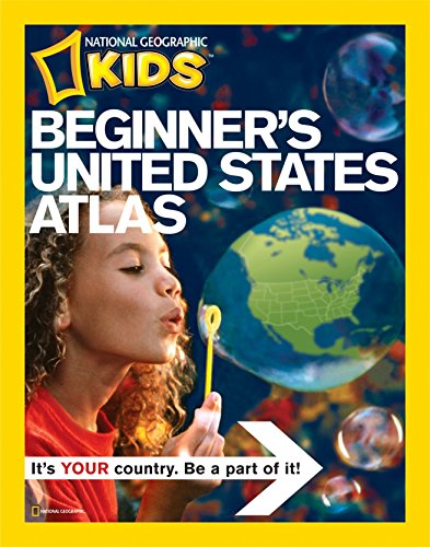 W
W
-
National Geographic Beginners World Atlas Updated Edition
National Geographic Society
Hardcover (National Geographic Children's Books, Nov. 1, 2005)All the political maps and statistics have been updated in this award-winning book. The society's world-renowned cartographers, working with education consultants and geographers have created a state-of-the-art world atlas for children ages 5 to 8. Large, easy-to-read maps introduce youngsters to the world and each of its continents. Full-color photographs, carefully selected for their appeal to young children, supplement the maps and make people, places, and natural wonders come to life. Through simple but fact-filled text, children begin exploring the world by learning about maps and how to read them. Then they begin their continent-by-continent tour. Each continent begins with a welcome from a young native child, followed by an illustrated physical map with brief bulleted discussions of land regions, water, climate, plants, and animals. Similar treatment is given to the political map except the topics are countries, cities, people, languages, and products. Each spread features full-color images that are keyed to the maps. Backmatter includes a map keyed to a chart of geographic superlatives, a glossary, a pronunciation guide, and an index. O
O
-
National Geographic Kids World Atlas
National Geographic
Library Binding (National Geographic Children's Books, July 9, 2013)National Geographic's classic atlas for kids is now fully revised and updated, with a reduced trim that makes it easy to carry and easy to browse. Complete with geo-themed games, crosswords, picture puzzles and more, this is the atlas for today's young explorers, as well as the perfect homework reference source.National Geographic is committed to being the number one provider of the best atlases for young people of all ages. This new edition of the award-winning world atlas for kids includes the latest data, newest maps and graphs, a fresh and compelling design, and lively essays about the world and its wonders.
V